ABOUT THORLEY LANE EAST WOODS
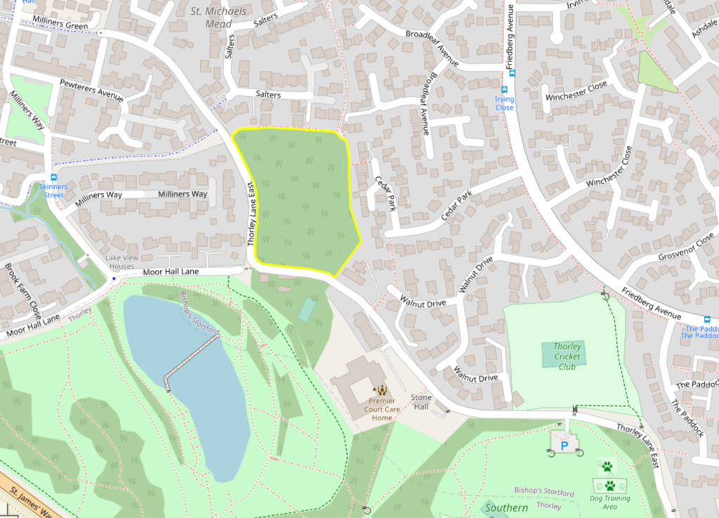
Where is the wood?
The focus of our campaign is the 3 acre mature woodland in Thorley Lane East, sandwiched between the developments of Thorley Park and St. Michael’s Mead in Bishop’s Stortford. The south west corner abuts the Southern Country Park and provides a continuation of the wildlife habitat provided by the park. We refer to the site throughout as Thorley Lane East Woods, although there is some ambiguity about its actual name.
The wood is untitled on Ordnance Survey maps, but was sometimes referred to by locals as “Rooks Wood” (on account of it being an important rookery site). The registered title of the site refers to Beechwood. The site is not to be confused with the actual “Thorley Wood”, which is a distinct (and rather depleted) woodland site at least a mile away, adjacent to the St. James Way bypass, at Thorley Wash.
For the purposes of our campaign, we are adopting the nomenclature of Thorley Lane East Woods to ensure consistency and ease of recognition.
Sometimes the woodland is referred to as being Woodland CM23 4JU, but the correct postcode area should be Woodland CM23 4BH.
Aerial View
The drone footage below has been produced by Barney Estates and Auctioneers as part of the sales pack for Thorley Lane East Woods.
The footage clearly shows:
- the maturity, density and beauty of the woodland within the context of the neighbouring housing estates; and
- how its conversion to development land would have a materially adverse and detrimental impact on a large number of surrounding houses; and
- how the loss of woodland would materially alter the ecosystem and green feel of the locality.

